

Bandelier surprised me in a good way. It was bigger and more compelling than I expected, and incredibly peaceful in the early spring. The entire area of roughy 33,000 acres is located inside the Jemez Mountain region, where massive volcanic eruptions were very active about 13 million years ago. Bandelier is situated on what is basically the side of an ancient huge volcano, the Valle Grande, which about 1 million years ago ejected a volume of material roughly 500 times that of the Mount St. Helens’ eruption of 1980. Today, the area is incredible ecologically diverse and my impression was that especially in the off season, it’s a bit of an underappreciated treasure in an area that enjoys an abundance of grand scaled parks and cultural legacies. There are 70 miles of trails available to explore, at all levels of difficulty.
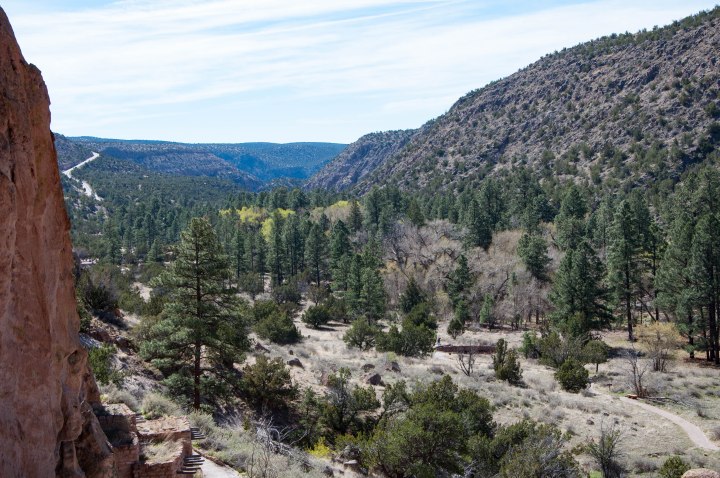 I spent a day hiking the area around the main visitors center. There were actually several good options here, including a very easy walk on flat, well maintained walkways through archaeological sites of standing masonry walls in the valley and also views of the cliff dwellings carved into the soft stone that surrounds the valley. Or, you can expand on that and hike up to the cliff dwellings which adds a modest challenge (my choice). The other option available is to take a longer hikes into the back country, and camp overnight. I suspect that in this area those would be quite nice.
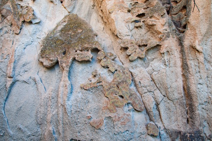
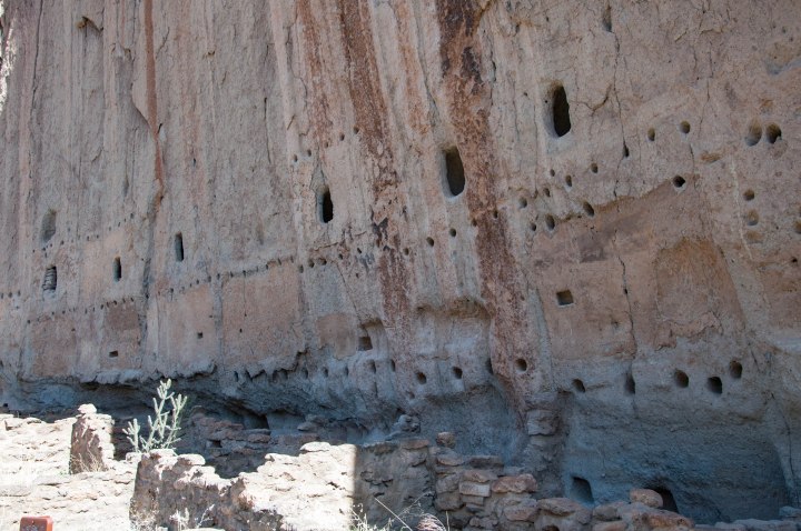
The park service is sensitive to the cultural legacy of this site, and so signage along the way is limited. For a small donation (less than $1) you can get a map of the Main Loop Trail in the bookstore, and I recommend doing that, because it helps you understand what you’re looking at and gives you some of the history of the pueblo people who lived here. The first thing I noticed was how the natural holes in the rock walls of the canyon served as a kind of camouflage for the man made holes that served as entries for the caves where people lived. I doubt if that made a difference when the valley was fully inhabited, but it was an interesting visual for me.
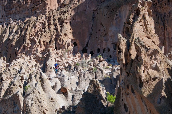
I went ahead and climbed up to the cliff dwellings for a closer look, and was surprised to see how much natural color there actually is in the rocks, which just looked red from afar.
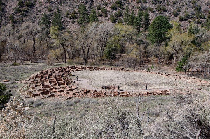
There were a variety of homes here, including the central area of masonry dwellings on the valley floor:
the loosely connected cliff dwellings above that:


and further into the valley I laughed with my fellow explorers when we stumbled upon the “high rent district”.
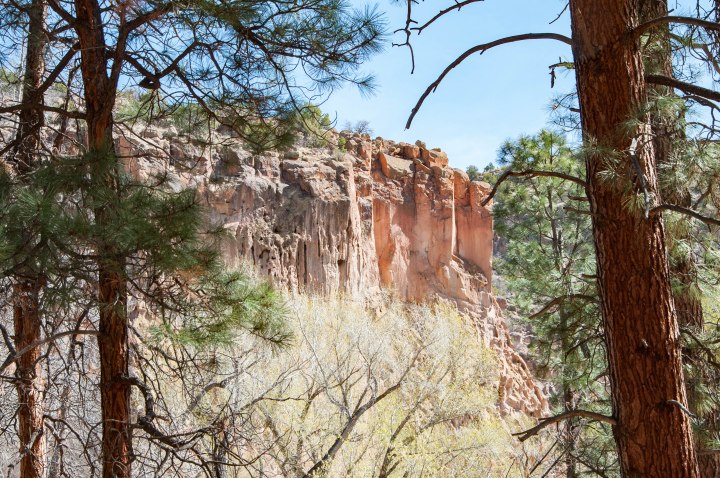
The walk back from the cliff dwellings crosses the river that flows through the valley, and the path meanders under the lovely shade of pine trees.
I also came across a sign that spoke to the history of a woman who lived much of her life in this park. Mrs. Evelyn Frey. According to the sign, Evelyn and George Frey moved to Frijoles Canyon in 1925 (with their infant son) to operate the Valley of the Ten Elders. The lodge was located in the area where the trail crosses and was surrounded by guest cabins, fruit trees, a large garden, and barns and pens for farm animals. When the Civilian Conservation Corps built a road into the canyon in the mid 1930s, and constructed the Frijoles Canyon Lodge (now stone buildings surrounding the Visitor’s Center), Mrs. Frey took charge of those as well. By historical accounts, she had a big personality and was a terrific storyteller, so I like her immediately. She lived in the canyon for nearly six decades and died peacefully in her cabin there.

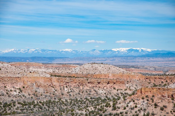
After my visit to Bandelier, I drove up to take a look at the Valles Caldera, which is what remains of the core of the huge volcanic eruption that created the topography seen in this area today. It is a spectacular vista and the heat from young volcanism makes the area attractive for geothermal energy:
I left the Bandelier area and headed back to Santa Fe via Los Alamos. I was surprised along the way when I had to stop on the main road at a security checkpoint, but the road goes literally right past the National Nuclear Research Laboratory, so that makes sense. I stopped for lunch at the Blue Window Cafe and had a remarkably tasty lunch with excellent service. The view on the way back down out of the mountains was beautiful.
Overall Impression: If I lived in this area, I think I would spend a lot of time here! It’s beautiful, with a lot of trails to explore. The cultural legacy here is also interesting, and in the valley, I felt you could really feel the presence of the people who lived here long ago. It’s probably worth noting that visiting in the early spring when there weren’t any crowds probably contributed to the peaceful nature of the day. 🙂 I noticed that in the summer, entrance is limited to the park shuttles due to traffic.
Total costs: There is a $20 per vehicle entrance fee, but that was included in my Annual National Park Pass, so it didn’t cost me anything. I donated $1 for the trail map. Lunch at the Blue Window was $28, including tip (I had a big lunch of both the lamb sandwich, then the chocolate mousse and coffee – all the hiking is making me hungry!)

Thank you for the wonderful photos and information. I continue to follow your travels with interest. Hi from “Itchy Hitchy” Pod in Virginia!!
LikeLike
Thank you for the feedback and hello!
LikeLike